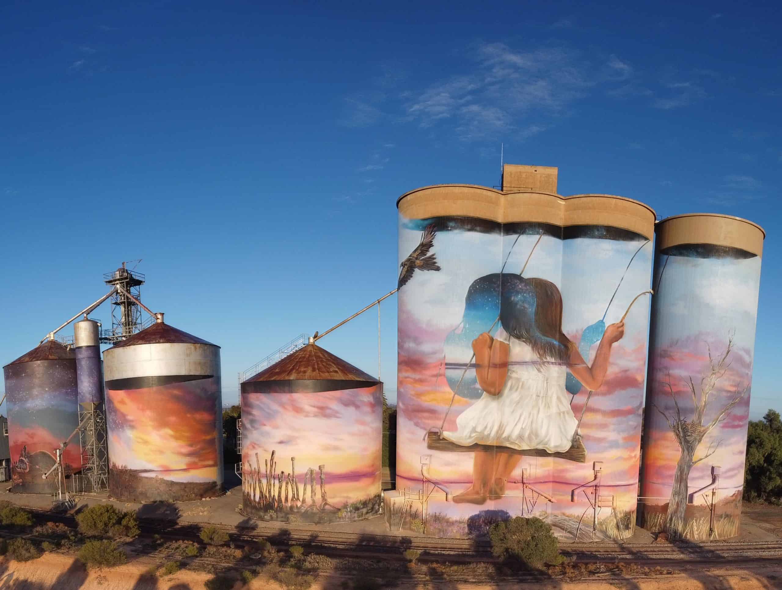
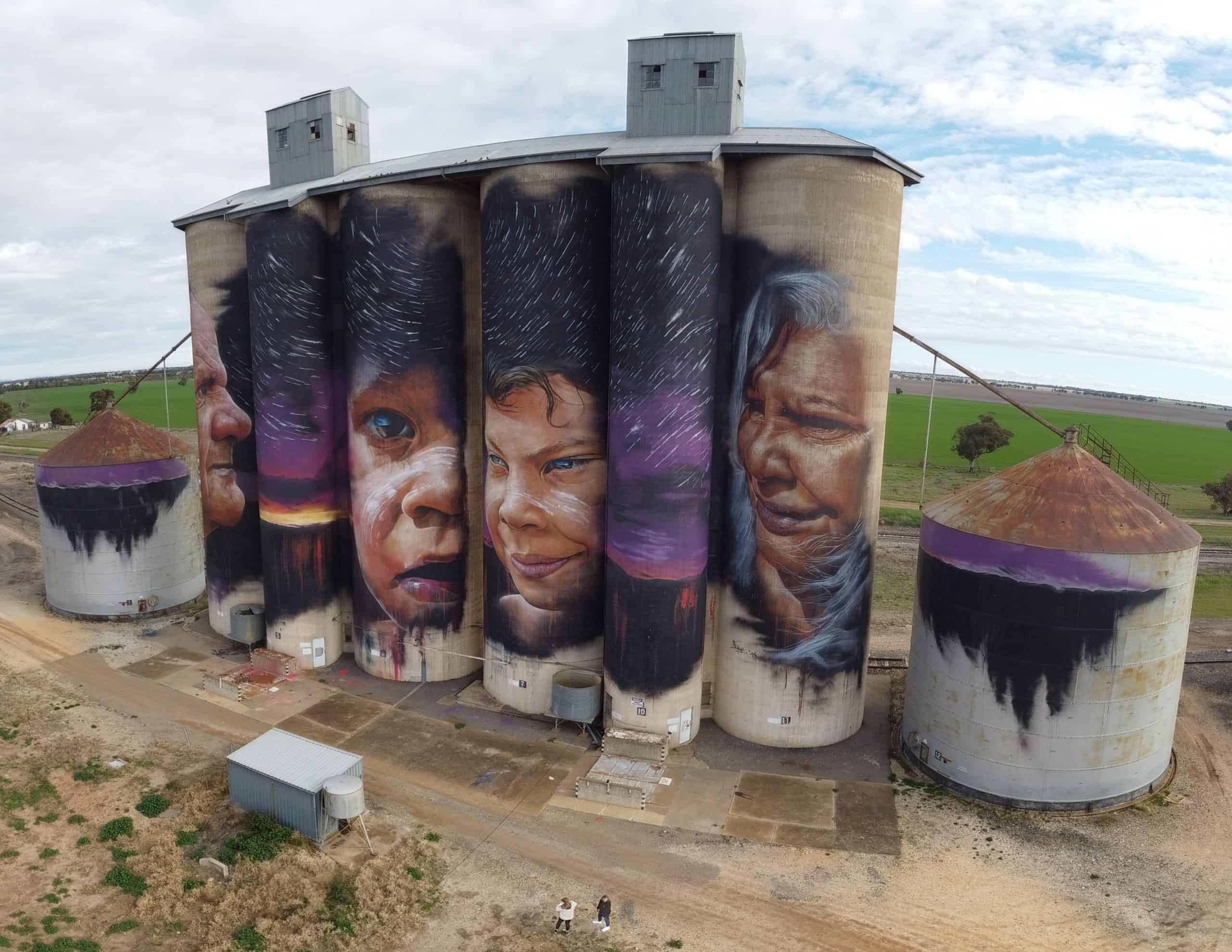
In July 2021, in the midst of the Covid pandemic, we got a short break from lockdowns and headed to northwest Victoria to visit the Silo Trail. Even our teenage kids loved the amazing artwork painted on the silos. Below are some of the photos I took with my drone.
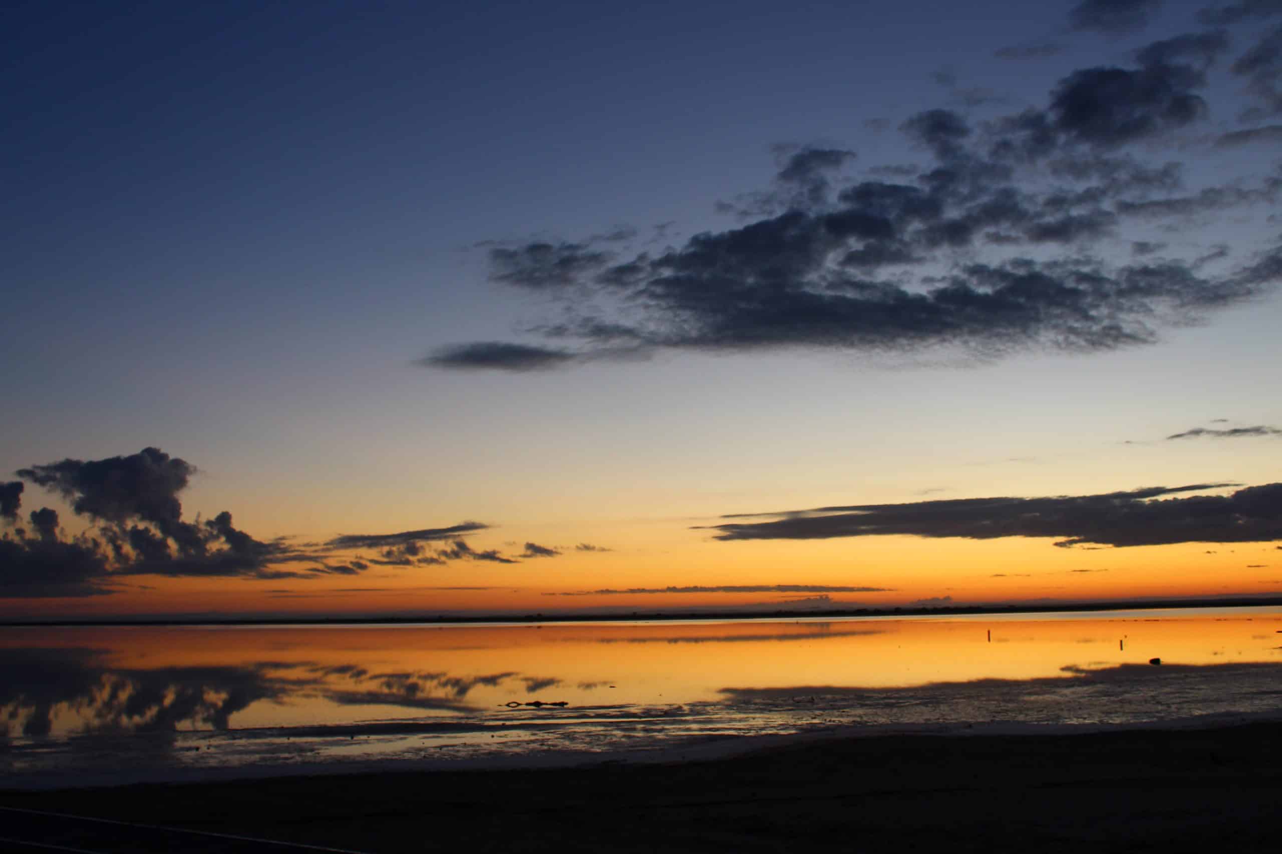
Our trip also included a sunset and a sunrise at Lake Tyrell.
If you would like to purchase any of these photos, please find high quality versions here: https://bit.ly/SkyStock
For more info on photographing the silos, feel free to check out my notes below the photos.
Colbinabbin – better photos late afternoon as the sun is behind the silos in morning. Sign noting no drones near silo and private property, no entry. Nothing about flying from car park or viewing area.
Rochester – morning photos are better. Picnic tables and grassy area in front of silos.
Nullawil – morning photos are better with afternoon sun from the side of silo. Picnic tables and shaded area in front of silos
Salt Lake – morning photos better.
Lascelles – morning but only 1 silo visible. Other silo is in the shade. Painting very faded.
Roseberry – afternoon photos would be better.
Brim – afternoon photos would be better. Parking across the road.
Sheep Hills – morning photos would be better.
Rupanyip – morning photos would be better. Sun directly behind silos at 3pm. Beware overhead power/telephone lines if you are flying a drone.